FOR HIKERS

Fire, smoke and storms — by trail mile.

Wildfire perimeters drawn along the PCT and the Appalachian Trail with trail miles, the smoke map and live radar — sent to the messenger on your pack strap.


WORKS WITH ZOLEO Garmin inReach SPOT X iPHONE SATELLITE
01 · WILDFIRE

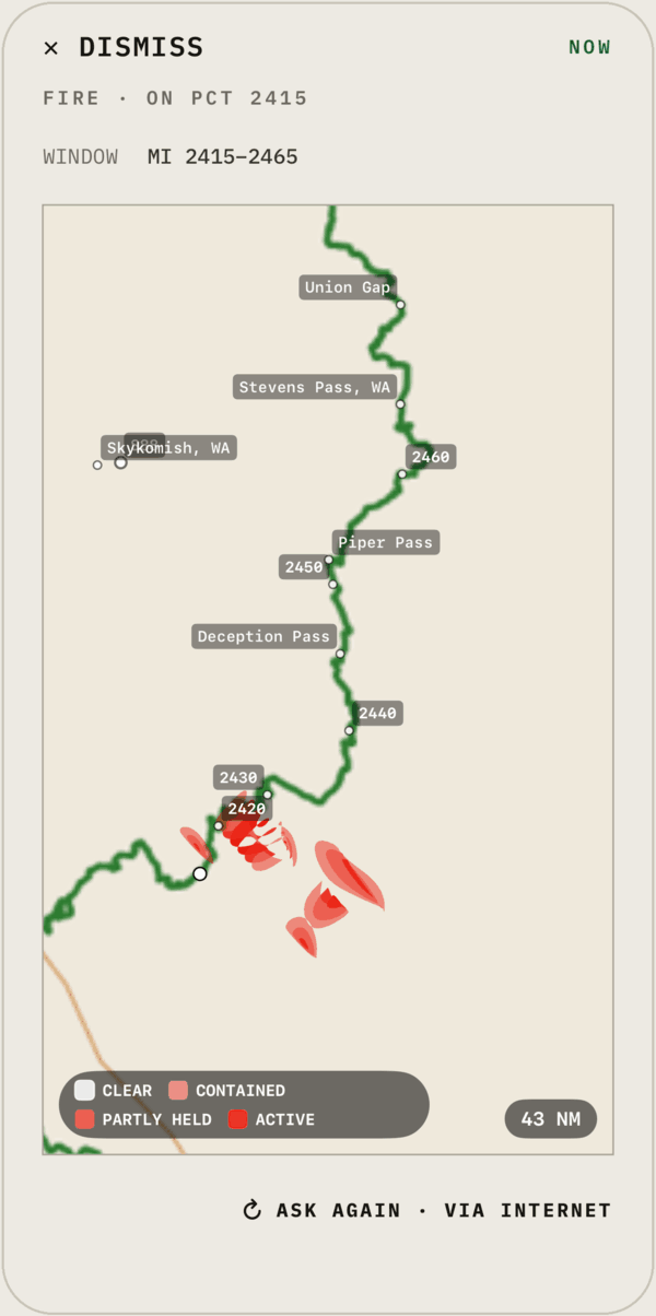
Know about the fire before mile 2420.

National fire perimeters graded active, partly held and contained, drawn along your trail with mile markers and landmarks.

pct 2415 firePacific Crest Trail: perimeters in your trail window1 MSG
at 840 fireAppalachian Trail: the same, by AT mile1 MSG
inc <lat,lon>Size and containment for fires nearby1 MSG
pct 2415 fireSENT · 1008Z · EXAMPLE
REPLY · FIRE
FIRE · 2415
FIRE AHEAD

Two perimeters within 5 mi of your window. Nearest partly held, 1.2 mi east of mile 2420.

HEAVYCLEAR
02 · SMOKE

Where the air turns bad.

A smoke map on an escalating grey ramp, so you can plan a zero day before the haze rolls in.
smokeAround your GPS positionMAP
03 · RADAR + LIGHTNING

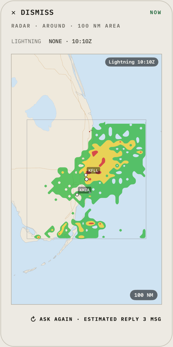
Before you commit to the ridge.

Precipitation cells and lightning strikes around you, at the detail you choose to spend.

radarAround your GPS position1–10 MSG
search is the Tuolumne Meadows store openSENT · 1008Z · EXAMPLE
REPLY · SEARCH · 1 MSG
TUOLUMNE · OPEN
FROM THE LIVE WEB

Open 8am–6pm daily through Sept 30. Resupply boxes held at the post office window, 9–5.

EVERY PLAN · ONLY ON BLIPSAT

Search the live web. Over satellite.

No satellite messenger can search the web. BlipSat’s AI reads it for you and replies in a message or two. Every reply is saved in the app, maps included.

Hike with it free.

1 month free in the iOS app, then $14.99/month in the US. Outside the US, the App Store shows the price in your local currency. Cancel any time.