PARTNERS · AGENCIES · FIELD TEAMS

Live data for teams past the last tower.

BlipSat puts fire perimeters, radar, marine forecasts and live web answers on the satellite communicators your teams already carry. No cell. No browser. No new hardware.

For search and rescue, fire and forestry, parks, utilities, research and expedition teams.
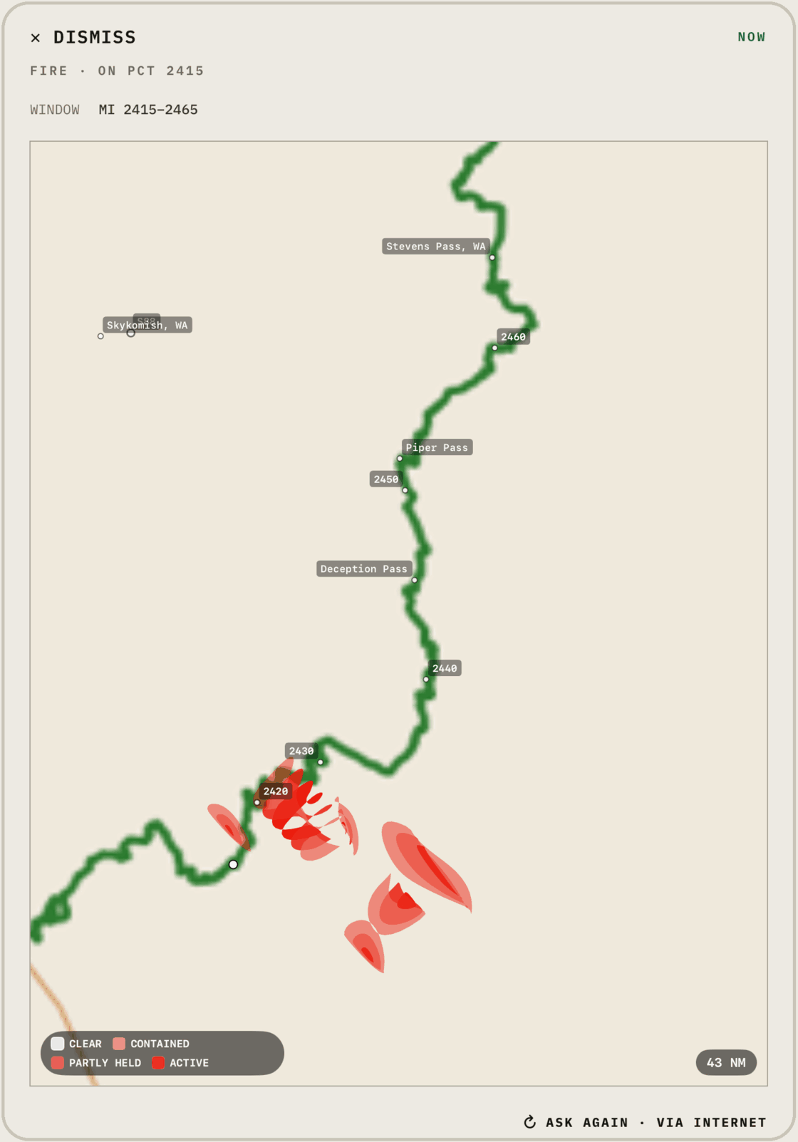
Fire perimeters delivered over satellite FIRE AHEAD · RECEIVED BY SATELLITE

What reaches the team.

FIRE · SMOKE
Fire and smoke
Nationwide perimeters graded active · partly held · contained, nearby incidents' size and containment, and the smoke map.
WEATHER
Radar + lightning
Precipitation cells and lightning strikes around a position or along a route, plus airport METAR and TAF.
MARINE
Waves, buoys, pressure
Wave height and period, the nearest buoy's observations and the surface pressure chart, now and +24h.
SEARCH
Live answers
Ask a question in plain words; BlipSat searches the live web and replies in a message or two.

From the feed to the field.

01 · SOURCE
Public fire, weather and marine feeds, checked continuously.
02 · PACK
BlipSat clips to the team's area and encodes it to a fixed message budget.
03 · SEND
Over Iridium or Globalstar to a ZOLEO, inReach or SPOT X.
04 · SEE
The paired phone redraws the map offline. Every reply is kept.

Built around your mission.

Every team works differently. We tailor BlipSat to the data you rely on, the words your crews use and the ground you cover — then deliver it over the satellite link you already have.

01 · YOUR DATA
Your feeds, on the device
Incident boards, station networks, asset positions or any source you depend on, packed to fit a satellite text.
02 · YOUR COMMANDS
Words your team uses
Short commands named for how you work, with replies sized to your message budget.
03 · YOUR AREA
Maps of your ground
Map areas and detail set to your district, route, coastline or region.
04 · YOUR DEVICES
What you already issue
ZOLEO, Garmin inReach, SPOT X, Bivy and iPhone satellite — or a device maker's own partner API.
CONTACT US

Tell us what your team needs.

Describe the data, the area and the devices, and we'll get back to you with the details — what we can build, how a pilot would run and what it costs. We can start with a handful of devices and report on what got through.


WORKS WITH ZOLEO Garmin inReach SPOT X iPHONE SATELLITE